
M5.1 - 72km W of Tonopah, Nevada (BETA) 2013-02-13 00:10:14 UTC
 Google Earth KML
Summary
Location and Magnitude contributed by: Nevada Seismological Laboratory
General
Nearby Cities
Additional Commentary
ML 5.1 (REN). Felt strongly in the Bishop-Mammoth Lakes, California area.
ShakeMap
Contributed by Nevada Seismological Laboratory
Instrumental Intensity
PGA (%g)
PGV (cm/s)
PSA 0.3s (%g)
PSA 1.0s (%g)
PSA 3.0s (%g)
Uncertainty
Station List
PAGER
Impact Estimates
Estimated Fatalities
Histogram of Estimated FatalitiesEstimated Economic Losses
Histogram of Estimated Economic LossesHistoric Seismicity
City Exposure List
See PAGER XML link (above).
Did You Feel It? Tell Us!
Contributed by USGS National Earthquake Information Center
Tell Us!
Did you feel this earthquake? Tell Us!
Intensity Maps
Graphs
Responses
Historic Seismicity
Current Year
Since 1990
Since 1900
Technical
Location and Magnitude contributed by: Nevada Seismological Laboratory
Summary
Preferred Location Parameters
| Parameter | Value | Uncertainty |
|---|---|---|
| Magnitude | 5.1 ml | Not Specified |
| Location | 38.028°N, 118.053°W | ± 1.7 km |
| Depth | 12.4 km | ± 2.7 km |
| Number of Stations Used | 22 | |
| Number of Phases Used | 22 | |
| Minimum Distance | 23.4 km (0.21°) | |
| Travel Time Residual | 0.1269 sec | |
| Azimuthal Gap | 124° | |
| Review Status | REVIEWED | |
| Event ID | nn00402688 |
Moment Tensor
Moment Tensor EQXMLContributed Solutions
Moment Tensor
Downloads
All Downloads
| Product | Title | Links | ID |
|---|---|---|---|
| dyfi (Preferred) (US) | DYFI City Map | nn00402688 | |
| dyfi (Preferred) (US) | DYFI Geocoded Map | nn00402688 | |
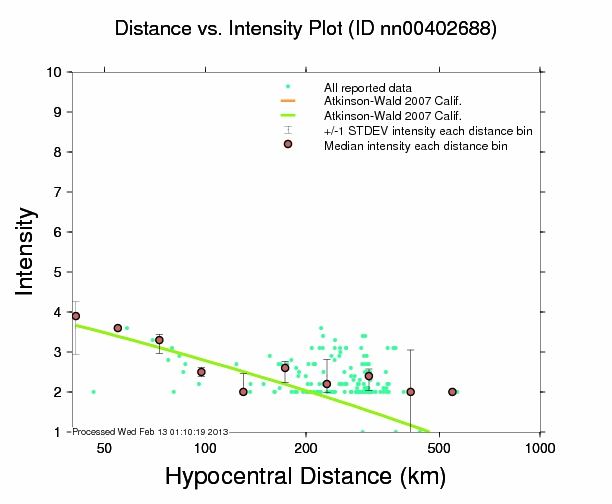
| dyfi (Preferred) (US) | Intensity vs. Distance Plot | nn00402688 | |
| dyfi (Preferred) (US) | Responses vs. Time Plot | nn00402688 | |
| dyfi (Preferred) (US) | Intensity Summary | nn00402688 | |
| dyfi (Preferred) (US) | Intensity Summary (Geocoded) | nn00402688 | |
| dyfi (Preferred) (US) | DYFI Combined Geospatial Data | nn00402688 | |
| historical-moment-tensor-map (Preferred) (US) | Historic USGS Moment Tensor Solutions Map | usc000f6ba | |
| historical-moment-tensor-map (Preferred) (US) | Historic USGS Moment Tensor Solutions Table | usc000f6ba | |
| losspager (Preferred) (US) | Exposure Map | nn00402688 | |
| losspager (Preferred) (US) | onePAGER summary | nn00402688 | |
| losspager (Preferred) (US) | PAGER XML results | nn00402688 | |
| losspager (Preferred) (US) | PAGER Exposure KML | nn00402688 | |
| moment-tensor (Preferred) (US) | Earthquake XML (Quakeml) | usc000f6ba | |
| moment-tensor (US) | Earthquake XML (EQXML) | nn00402688 | |
| origin (Preferred) (NN) | Earthquake XML (EQXML) | nn00402688 | |
| origin (US) | Earthquake XML (EQXML) | usc000f6ba | |
| p-wave-travel-times (Preferred) (US) | Theoretical P-Wave Travel Times Map for the World | usc000f6ba | |
| p-wave-travel-times (Preferred) (US) | Theoretical P-Wave Travel Times Map for the United States | usc000f6ba | |
| p-wave-travel-times (Preferred) (US) | Theoretical P-Wave Travel Times Table | usc000f6ba | |
| phase-data (Preferred) (US) | Earthquake XML (EQXML) | usc000f6ba |
The use of EQXML formatted data is temporary. This data will be changing to QuakeML v1.2RC3 format.
