
![[Sketch of the battles of Chancellorsville, Salem Church, and Fredericksburg], May 2, 3, and 4, 1863](https://cybercemetery.unt.edu/archive/oilspill/20130302015706im_/http://www.loc.gov/collections/static/civil-war-maps/images/cwh00129.jpg)
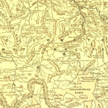
![[Map of Madison County, Va.].](https://cybercemetery.unt.edu/archive/oilspill/20130302015706im_/http://www.loc.gov/collections/static/hotchkiss-maps/images/cwh00046.jpg)

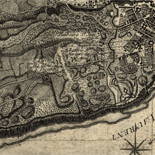
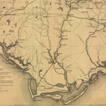
![Plan général du Fort Septentrional du Detour des Anglois, tel qu'il est présentement : [Louisiana]](https://cybercemetery.unt.edu/archive/oilspill/20130302015706im_/http://www.loc.gov/collections/static/louisiana-european-explorations-and-the-louisiana-purchase/images/lh000949.jpg)
![Boston its environs and harbour, with the rebels works raised against that town in 1775... Sir Thomas Hyde Page, [1775?].](https://cybercemetery.unt.edu/archive/oilspill/20130302015706im_/http://www.loc.gov/collections/static/american-revolutionary-war-maps/images/ct000070.jpg)
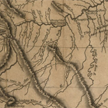
![[Map of cavalry engagement near Bridgewater, Va. Oct. 4th and 5th, 1864]](https://cybercemetery.unt.edu/archive/oilspill/20130302015706im_/http://www.loc.gov/collections/static/hotchkiss-maps/images/cwh00193.jpg)
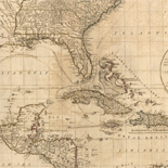
![Carte particulière d'une partie de la Louisianne ou les fleuve et rivierres [i.e. rivières] onts etés relevé a l'estime & les routtes [i.e. routes] par terre relevé & mesurées aux pas, par les Srs. Broutin, de Vergés, ingénieurs & Saucier dessinateur](https://cybercemetery.unt.edu/archive/oilspill/20130302015706im_/http://www.loc.gov/collections/static/louisiana-european-explorations-and-the-louisiana-purchase/images/ct000681.jpg)
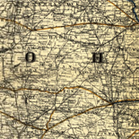
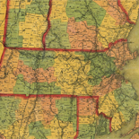
![A correct map of a section of the United States showing the allignment [sic] of the Pittsburgh, Marion, and Chicago Railway between Chewton, Penna. and Marion, Ohio and connections.](https://cybercemetery.unt.edu/archive/oilspill/20130302015706im_/http://www.loc.gov/collections/static/railroad-maps-1828-to-1900/images/rr005350.jpg)
Results
Refined by:
Original Format: Map-

Lithuania.
"9-91." Available also through the Library of Congress Web site as a raster image. Includes note. "Base 801808 (B01013)." 1 map : col. ; 18 x 17 cm.
Contributor: united states. central intelligence agency Site: American Memory-cultural - Main Catalog Original Format: Map Date: 1991 View catalog record -
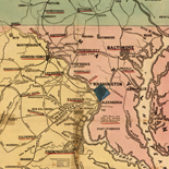
Johnson's map of the vicinity of Richmond, and Peninsular Campaign in Virginia : showing also the interesting localities along the James, Chickahominy and York rivers ...
Relief shown by hachures. Depths shown by soundings. "Entered according to Act of Congress, in the year 1862 by J. Knowles Hare in the clerk's office of the District Court of the ...
Contributor: johnson, a. j. Site: American Memory-cultural - Main Catalog Original Format: Map Date: 1862 View catalog record -

Plano de la Bahía de Roxas en el Estrecho de Magallanes en la Ysla de Carlos III cituada su mediania por latud S. de 53" ...
Bahía de Roxas unidentifiable on modern maps and/or in gazetteers. Depths shown by soundings. Prime meridian: Cádiz. Oriented with north toward the upper left. Watermark: Strasburg fleur-de-lis. Pen-and-ink. Mounted on cloth backing. ...
Site: American Memory-cultural - Main Catalog Original Format: Map Date: 1786 View catalog record -

Memoranda, April 9, 1865, 10 o'clock A.M., Clover Hill (Appomattox Court House) Virginia.
Shows Appomattox Court House and vicinity at the time of Lee's surrender, including troop positions. Pen-and-ink on paper, mounted on cloth. This map was received in the library in an envelope marked ...
Site: American Memory-cultural - Main Catalog Original Format: Map Date: 1865-04-09 View catalog record -

[March 1, 1945], HQ Twelfth Army Group situation map.
Available also through the Library of Congress web site as a raster image. 1 map : col. ; 47 x 52 cm.
Contributor: allied forces. army group, 12th. engineer section Site: American Memory-cultural - Main Catalog Original Format: Map Date: 1945-03-01 View catalog record -

Map of Susquehanna Co., Pennsylvania.
LC Land ownership maps, 799 Available also through the Library of Congress Web site as a raster image. 1 map.
Site: American Memory-cultural Original Format: Map -

Atlas pintoresco é histórico de los Estados Unidos Mexicanos.
Maps have border illustrations, including portraits. Available also through the Library of Congress Web site as a raster image. [1] l. 13 col. maps 63 x 80 cm.
Contributor: garcía cubas, antonio - garcía cubas, antonio Site: American Memory-cultural - Main Catalog Original Format: Map Date: 1885 View catalog record -

Atlas of the Middle East /
G.P.O. sales statement incorrect in publication. Shipping list no.: 93-0430-P. "January 1993." Two folded maps attached on 1 sheet, back to back, col.: Middle East. Scale 1:4,500,000. "802122 (R00015) 4-93," and Middle ...
Contributor: united states. central intelligence agency Site: American Memory-cultural - Main Catalog Original Format: Map Date: 1993 View catalog record -

Plano de la rada de Lugan Nuebo situada en la costa de España al ote. del Cabo de Sta. Pola en latd. de 38 gs. ...
Shows coast of Santa Pola region. Relief shown pictorially. Depths shown by soundings. Watermarks: IV, J. Kool, and Strasburg fleur-de-lis. Pen-and-ink. Mounted on cloth backing. LC Luso-Hispanic World, 790 Available also through ...
Contributor: martínez núñez, joseph - martínez núñez, joseph Site: American Memory-cultural - Main Catalog Original Format: Map Date: 1785 View catalog record -

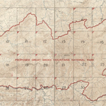
Relief map, Rocky Mountain National Park : Colorado centennial, 1859-1959 /
Relief shown by contour lines, shading and spot heights. Available also through the Library of Congress Web site as a raster image. 1 map : col. ; 53 x 41 cm.
Contributor: sprecher, j. m. Site: American Memory-cultural - Main Catalog Original Format: Map Date: 1959 View catalog record -

Andorra.
"Base 504784 (546491) 2-82." Relief shown by shading. Available also through the Library of Congress Web site as a raster image. 1 map : col. ; 21 x 17 cm.
Contributor: united states. central intelligence agency Site: American Memory-cultural - Main Catalog Original Format: Map Date: 1982 View catalog record -

Southeast Brazil.
"13470.1 10-54." Includes 6 ancillary maps. Available also through the Library of Congress Web site as a raster image. 1 map : col. ; 78 x 56 cm.
Contributor: united states. central intelligence agency Site: American Memory-cultural - Main Catalog Original Format: Map Date: 1954 View catalog record -

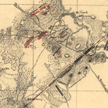
[Union troop positions northwest of Marietta, Georgia, June 10-July 3, 1864].
Relief shown by hachures. Title from Stephenson's Civil War maps, 1989. LC Civil War maps (2nd ed.), S93, 195 Available also through the Library of Congress Web site as a raster image. ...
Site: American Memory-cultural - Main Catalog Original Format: Map Date: 1864-07-03 View catalog record -
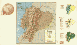
Ecuador.
"Base 501178 6-73." Relief shown by shading and spot heights. Available also through the Library of Congress Web site as a raster image. Includes inset of "Galapagos Islands (Archipiélago de Colón)," comparative ...
Contributor: united states. central intelligence agency Site: American Memory-cultural - Main Catalog Original Format: Map Date: 1973 View catalog record -

A plan of the island of Burlington : and a view of the city from the River Delaware /
Cadastral map showing buildings, lot lines, orchards, and gardens. Oriented with north toward the lower left. Includes index to points of interest and panoramic view at bottom of sheet. Available also through ...
Contributor: birch, william russell Site: American Memory-cultural - Main Catalog Original Format: Map Date: 1797 View catalog record -

Mexico.
Available also through the Library of Congress Web site as a raster image. Shipping list no.: 89-48-P. "Base 801219 (546155) 8-88." 1 map : col. ; 17 x 21 cm.
Contributor: united states. central intelligence agency Site: American Memory-cultural - Main Catalog Original Format: Map Date: 1988 View catalog record -

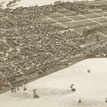
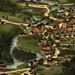
Bird's eye view of the city of Muskegon, Muskegon Co., Michigan 1868.
Perspective map not drawn to scale. LC Panoramic maps (2nd ed.) 364 Available also through the Library of Congress Web site as a raster image. Indexed for points of interest. col. map ...
Contributor: ruger, a. Site: American Memory-cultural - Main Catalog Original Format: Map Date: 1868 View catalog record -

Map of Caroline /
Shows names of some residents. Relief shown by hachures. "Map from the Confederate Engineer Bureau in Richmond, Va. General J.F. Gilmer, chief engineer. Presented to the Virginia Historical Society by his only ...
Contributor: gilmer, jeremy francis Site: American Memory-cultural Original Format: Map -

Map showing the investment and siege of Savannah, Georgia by Genl Sherman's army Decr 1864.
"Savannah had a population of about 25,00 [and] was strongly fortified and held by Rebel Genl. Hardee with an army of 15,000. These evacuated the city escaping by pontoon bridge to the ...
Contributor: sneden, robert knox Site: American Memory-cultural Original Format: Map Date: 1861 -

[Map of the environs of Vicksburg, Mississippi, 1863]
Title, scale, and date from Stephenson's Civil War Maps, 1989. Pen and ink sketch map drawn on tracing cloth, showing roads in red, principal rivers in blue, and "Vicksburg & Jackson R.R.," ...
Site: American Memory-cultural - Main Catalog Original Format: Map Date: 1863 View catalog record